Fly Cat Island
An up-to-date comprehensive online resource for general aviation pilots flying to Cat Island, Bahamas.

- * See money-saving offers for Private Pilots below (scroll down).
- *NEW: Cat Island airports now require use of the Airport Authority App to pay parking and landing fees. Suggest download on your phone -- set up profile in advance. (Not related to Customs).
- *MYCB - New Bight Airport - OPEN: A new 7000' foot runway oriented about 30 degrees from the existing is currently under construction. The latest tentative closure now is February 2027 at which point they expect to finish the intersection of old and new.
- *MYCA - Arthurs Town Airport - NOW OPEN - New 7000' x 150' runway and new terminal
- Note: Customs available at MYCA by prior request only - email or Whats App us here for more info
MYCB New Bight Airport
Pilot Information• New Bight International Airport, Cat Island, Bahamas
• IATA: TBI, ICAO: MYCB
• Airnav MYCB summary page here• Bahamas government owned, non-towered airport of entry• Customs/Immigration 0900-1700 local seven days
• Location 24 degrees 19 minutes North; 75 degrees 27 mins West
• Located in the center of Cat Island
• No approaches. Often broken layer at 2000-3000 with holes
• Suggest cancel with Miami above 3000' once island in sight
• If unable to cancel in air, Nassau 242-377-7108 or 242-377-7116
• 09 is the preferred runway 90% of the time
• Most locals fly straight in to 09 or a left base entry • 118 nm from Nassau VOR 114 degree radial• 280 nm from KFXE heading 119 degrees• Field elevation 6’• Runways 09/27 5000’ X 100‘ paved: middle 50' "excellent," outer 25' either side: "good" with patches. Note, the runway is a total of 100' wide. The middle 50' has been repaved, leaving 25' original pavement on either side which does NOT drop off from the middle new pavement. I.e, safe to "straddle" if necessary.
• Runway 09 has trees and a road in its short approach zone; plan on dropping in after the road and fence to the threshold.
• Eastern Time Zone
• 2 bars of cellular service on the field• Paved parking for 10 airplanes
• No tie-downs, no chocks -- bring you own
• CTAF 122.8
• AWOS 127.7 (winds, altimeter, and clouds)
• Nassau Radio 128.0
• No UNICOM, No NAVAIDS, NO FUEL, NO FBO
• No ADS-B weather inflight available (nothing east of Nassau)
• SXM signal available inflight (music) and SXM weather will show as "available" but there is no actual WX radar feed "in it" east of Nassau. (The Bahamas does not provide their radar to SXM)
• Bahamas radar (for on the ground flight planning)
• "Windy" app is a good source of local weather.
• Customs at MYCB does NOT require advance notification, but you can email us for their discreet What's App number if you wish to. While they are "officially" open from 7a-Sunset, best advice is to plan arrival times between 9a-5p.
• Customs/Immigration fees: For "recreational" (non-commercial) aircraft: $150/aircraft inbound, $0 outbound. $31/per person outbound. The magic words with Customs you need to use are "recreational aircraft."• Customs/Immigration fees: For "commercial charter" with four seats or less: $75/inbound and $75/outbound, $31/per person outbound.• Customs/Immigration fees: For "commercial charter" with more than four seats: $150 inbound and $150 outbound. $31/per person outbound. • No flaggers - park wherever you can find a space...but....
• Please Don't park in front of hangar taxiway nor block 10' on either side of the active taxiway w/ your wings.
- Make sure all passports are current, you have them with you, and there's 6 months left on it before expiration. Check this in advance and plan ahead. This is a potential show-stopper.
- Customs accepts US cash or Bahamian (exact change strongly recommended). They also accept Visa/MC for the customs/immigration fees (when the credit card machine works).
- Airport Authority fees: In the past, it's been cash only for the landing ($7.70) and parking fees (assessed after the second night parked; first night is "free.") However the Airport Authority at MYCB (which is located in the terminal vs. customs which is in the trailer) is now strictly requiring use of the Airport Authority app to pay landing/parking fees. If you have not pre-signed up and loaded all your info, they may make you stand there and struggle through it on the spot before letting you depart the premises. Best to do it before. Note: this is separate and unrelated to Customs fees/apps.
- Recommend Flashpass for US eApis exit/entry. 30 days free
- When using Flashpass, it automatically pre-populates the C7a form (entry) for Bahamas customs or the C7 (exit Bahamas). If not using Flashpass, here are the blank C7 (exit Bahamas) and C7a (enter Bahamas) forms for download.
- Security of your aircraft: The field is mostly fenced in and locked at sunset. During the day, it is attended and secured. The airport personnel are actually rather strict about security; moreso than at most Bahamas out island airports.
- VFR flight is not legal at night in the Bahamas sunset to sunrise.
- Use of Whats App messenger app is recommended for most local calls/texts.
- Car rentals best arranged in advance with Shaquile 242-801-0979 (Alvernia Food store) or Berto 242-474-1050 (New Bight food store) or (New Bight Gas Station & Car Rental) Ethera 242-813-0300. They all will pick you up at MYCB.
- Driving on Cat Island is on the left. The road is under constant re-paving construction so some stretches are very rough. Big potholes also are the norm to drive around. Google Maps GPS works for destinations on the main road, BUT don't let it take you off the main road without you first acquiring local knowledge/advice. It can often lead you to an impassable road.
- Gas stations. Plan ahead: Most not open Sundays/holidays. There is no "self serve." All gas is shipped in by boat and it's not unusual for the stations to be out of gas (especially between Christmas and New Years). If you pass a gas station, and they have gas...get it while you can. Note: your rental car may very well not come with a full tank of gas...so take a look at it and fill up when you can. Autogas is currently $8.75/gallon. Cash (US or Bahamian) only; no credit cards.
- Groceries and provisions can also be had easily at the above stores. (New Bight Food Store also has beer, wine, and liquor).
- Beer, wine, and liquor: Gilbert's New Bight Food Market, 700 Liquor Store (both south of MYCB). Michael's Neighborhood Convenience and Liquor Store. (Heading north from MYCB) next to Bank of Bahamas.
- Bank of Bahamas: On Queens Highway north of the airport. Monday to Thursday 9:30a.m. - 3:00p.m. Friday 9:30am - 3:30 pm. (242) 342-2230. This is the ONLY bank on Cat Island.
- Taxi (and island guide): Danson (Danny) King 242-474-8462. Other taxis.
- U.S. cell phones will work (usually), check with your carrier for day pass rates.
- U.S. currency accepted everywhere and is 1:1 with Bahamian dollar.
- Power is 120v, U.S. style plugs. No converters/adaptors needed. Power/cell phone outages are common. Most of the resorts/hotels have generators (when they work) but many AirBnB type rentals do not.
- Closest AvGas and JetA fuel is Stella Maris airport, Long Island (MYLS - stellamarisairport@gmail.com, (242) 338-2006 ) to the south or Governor's Harbour airport, Eleuthera (MYEM - tripsupport@earcoaviation.com ) to the north. Also North Eleuthera airport (MYEH- frontdesk@whitecrownaviation.com). Suggest emailing to verify fuel availability before going there. All three have Customs/Immigration 7 days.
- How to depart MYCB: When planning your departure from Cat Island, suggest you file your eApis and flight plan via Foreflight (or other EFB) via wifi at your accommodations rather than relying on cell service at MYCB.
- After departing VFR, (it's not practically possible to depart IFR from the ground) pick up your IFR flight plan in-air from Miami Center (out of 3500-4000'): 127.22
Other Cat Island Airports
Arthurs Town Airport (MYCA) (below) NOW OPEN in the North of Cat Island, operated by the government now open with brand new rebuilt 7000 x 150' (12/30) runway and new terminal. Large apron for parking. No FBO. No Fuel No approach. CTAF 122.8. Customs is not available/staffed. Email us or what's app for more info.
- Hawks Nest Airport (MYCH) (below) is open and on the southern most tip of Cat Island. Unlike MYCB and MYCA, it is privately owned by Hawk's Nest Resort & Marina. • For prior permission: 1-242-342-7050. • Lat/Long N24-09.2/W075-31.3 • 3100' x 80' (It's really 5000' but has a displaced threshold which kills 2000' due to the "too close to the runway" of two small buildings) • Surface is in very good condition • No fuel, no navaids, no unicom, no FBO • No customs onsite, but MYCB customs officers, by prior call and fee, workload permitting, will drive there to check you in • They do have some chocks, but always good to bring your own Hard surface parking for 3-4 aircraft
- • Restaurant onsite.
Cutlass Bay Airport (MYCX) (below) is closed. It's on the southern center area of Cat Island, very close to the well-known beach bar, Da Pink Chicken. It is defunct, abandoned, overgrown, and unusable.
The field was originally built to service the Cutlass Bay Club resort, in the early 1960s by Jim Frew, president Windward Island Properties. Later on, in a reincarnation of the property, the lessees of the Cutlass Bay Club ran a clothing-optional resort, and they closed the airport in the 1990s. These folks caused so much animosity with the locals that the club was burned down.
While the strip has been plowed under in places and overgrown with trees, there still stands the very first hangar on Cat Island (built by Bob Graf, owner of Graf Jets out of Ft. Lauderdale). The airport has a colorful history as part the infamous Bahamas drug running trade discussed in detail in Michael S. Kennedy's great book about Cutlass Bay Club The Last Resort).
A non-exhaustive list of major attractions
A short cheat-sheet of "to-do's" on Cat Island. There are others, certainly, but these are the most well-known. All require a car. As with most bars/restaurants on the island, open-hours/days can be sporadic, so best to call (or What's App text) ahead to make sure. Note: On Holidays most restaurants will be closed, plan ahead and check with them in advance via What's App.
• Mt. Alvernia. Highest point in the Bahamas. Great views plus hand-carved Stations Of The Cross and monestary by Father Jerome. Short drive south from the Airport. Easy "hike" up, even easier walk down on the back side.
• The "Fish Fry" at "The Regatta Site." Short drive south from the Airport, not far from Mt. Alvernia. Several small restaurants for traditional Bahamian fare. Hidden Treasures 242-424-9237 or 242-812-5570. Blue Waters Restaurant 242-342-3341. Tingum Dem Restaurant 242-806-4326.
• Also at the Fish Fry: Duke's Conch Stand for Conch Salad. 242-474-2384
• Olive's Bakery. South of MYCB, near the south entrance to the Fish Fry on the main road just before Police station going south. Well known bakery for breads, treats, and Bahamian "Flour Cakes." 242-342-3134 or 242-464-6181. pastorcdhking@gmail.com
• The Healing Pond. South end of the island (same road that takes you to Greenwood Resort; see below). Float like the Dead Sea for reported healing properties. Bring water shoes or Teva-type sandals. • After the Healing Pond, go right down the road to Greenwood Resort. Have a beer and lunch there overlooking the Atlantic side.
• Da Pink Chicken. Also in the South, one of the best known beach bars in the Bahamas. Fridays, Saturdays, Sundays.
• Da Smoke Pot. In the North. Also one of the best known bars/restaurants on the island.
• Curly's New Restaurant and Resort. In the North. 242-814-2875. or 242-544-7258.
• Power boats: You won't find power boats for rent on Cat, but you can charter a power boat, with its captain, for a day's fishing or on the water sightseeing. You normally will come back with a full cooler of fish. What's App text (or call) Carl Pinder 1-242-474-2613 or Jeremy Gilbert 1-242-442-0033.
• Scooters, ATV rentals, JetSki rentals: New Bight Gas Station & Car Rental: 242-813-0300.
• Ecotours, kitesurfing, diving, sailing, and other activities.
• Massage on the beach. Sheila Hunter comes to you with a table, linens, etc. What's app or call 1-242-464-6002.
• Further resources (activities, gas stations, lodging, etc)
• Pay for service medical clinic: Cat Island Medical (located next to Alvernia Foods across from the town dock). Has a physician staffed every day and also has the only (digital) X-ray on the island.
What's happening with the "new" New Bight Airport?
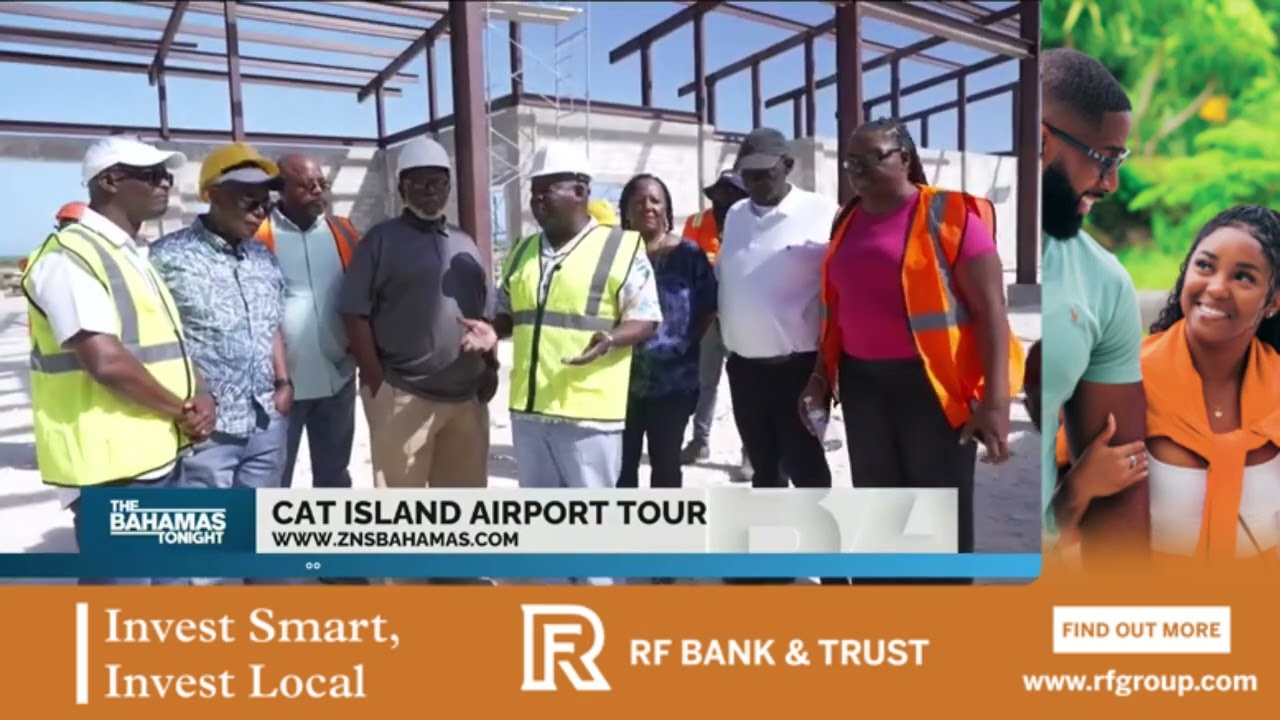
The Bahamas government is in the (long overdue) process of rebuilding New Bight Airport. It is destined to be a "Tier 2" international airport with a 7000' runway. More details about the plans from Prime Minister Davis can be read here.
A completely new terminal is currently under construction (and has been for about two years). It's about 90% complete. The existing runway (5000') was recently "temporarily" partially resurfaced and it's now in excellent shape. A completely new 7000' runway is being built about 30 degrees cross to the existing. The existing will then be bulldozed. A new, separate, fire station, police station, and "lookout tower" are also under construction adjacent to the new terminal. There is no word yet about plans for Avgas and JetA availability, although we are hoping!
When will it all be done? Good question. Best guess is late 2026. or early 2027 At some point, perhaps Fall of 2026 they will close MYCB to finish the new runway. Work is proceeding... See a video update here. Another video update from February 13th 2025 below.
And How about those roads?
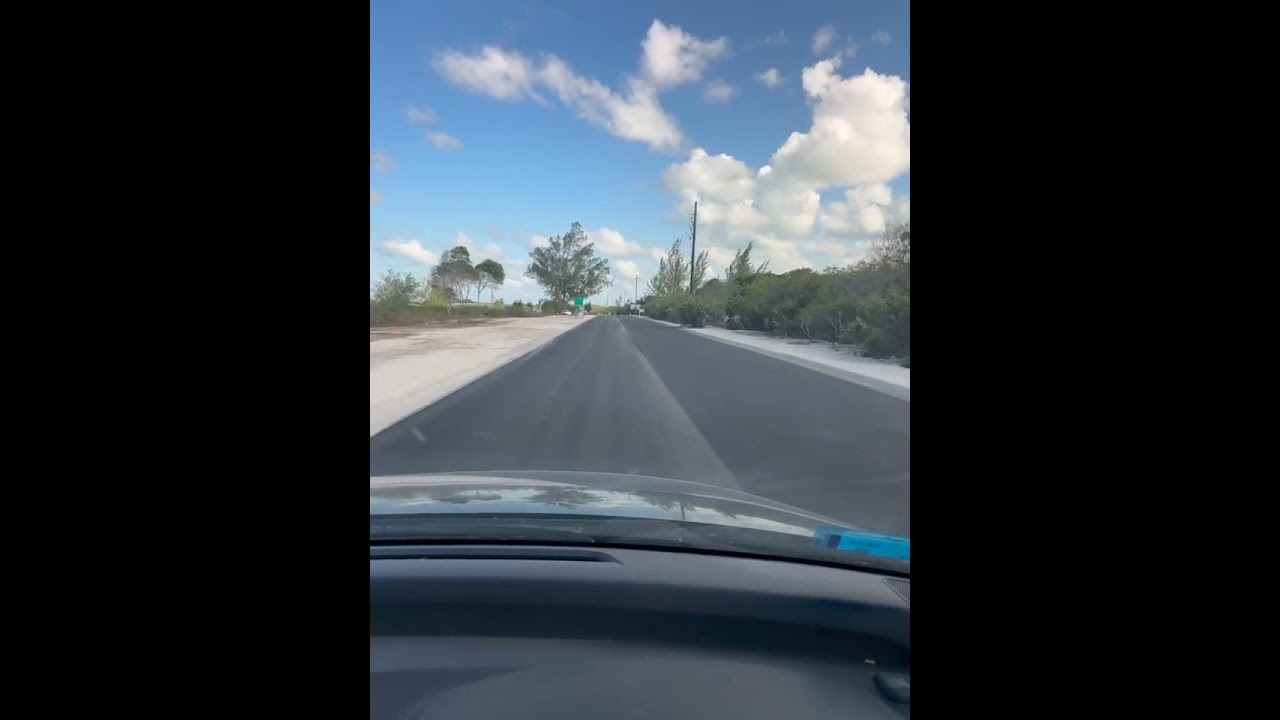
Cat Island has about 45 miles of main road called "Queen's Highway. " It was last paved over 30 years ago and has been littered with huge potholes making it a constant obstacle course to drive. (on the left side, FYI). The government has deployed a $80 million project to repave the entire stretch. An asphalt plant has been built and is operational. Large stretches of the road island wide have now been widened and repaved. The rest of the road's potholes have been patched (more or less) making driving much less hazardous than it was.
Contact participating hotels directly: